Lava Beds National Monument Scenic Drive
Table of Contents
Lava Beds National Museum Scenic Drive
Location: northeastern California, in Siskiyou and Modoc counties
Length: 9.3 miles
Difficulty: easy to moderate
Features: hiking, caves, petroglyphs, lava beds, lave tube,
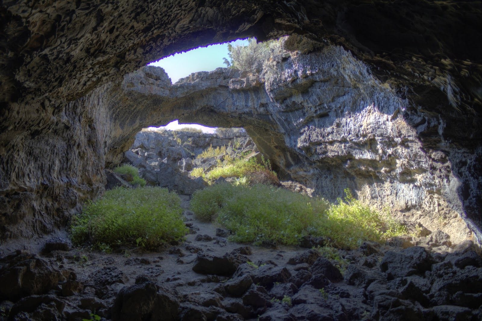
A point-to-point trail made up of 13 exciting cave trails. It is near Tulelake and where you can expect to see several types of wildlife. The highest elevation you can reach on the trail is 286 m. This trail is purely for hiking as pets, bicycles and motor vehicle is not allowed.The eruption of the Medicine Lake shield volcanoes paved way for the very interesting sites in this trail including cinder cones, lava beds and almost 700 lava tubes. This is the most number of lava tubes in one place that can be found in the country.
Trails In The Lava Beds National Monument
The trails vary in distance from 9.4 miles to the shortest 0.3 mile. Unfortunately, some of them are closed due to wildfire.
Heppe Cave Trail is a short 0.4 mile one way trail ending with a huge lava tube collapse. It goes through Ponderosa pines and through the forest, along the gravel roads leading to Mammoth Crater. More adventures awaits if you go further to Heppe Ice Cave where you will see ice formations if you came during the right season.
Captain Jacks Stronghold Trail – 0.5 mi / 0.8 km (Inner), 1.5 mi / 2.4 km (Outer)
This interpretative trail got its name as it is connected to a wartime defense in Mordoc. You can take the inner trail with length of 0.5 miles or the outer trail spanning 1.5 miles. It’s been confirmed to have really rough terrains from trailhead at the parking area north of the monument. For now, it’s unfortunately close due to wildfire.
Gillem Bluff Trail – From the northern most tip of the moment, this trail takes you on a 0.7 mile 550 feet climb towards Gillem Bluff (Sheepy Ridge). Breathtaking views awaits you there!
Schonchin Butte Trail – This 0.7 miles trail goes from the trailhead and atop a cinder cone 500 feet from the ground. There’s a fire lookout with magnificent views of the monument and vast basin.
Missing Link Trail A trail also at 0.7 miles linking the Three Sisters Trail and Bunchgrass Trail. In total, you go through a 10-mile loop from Bunchgrass Trail, across the street from the Symbol Bridge pullout, along Skull Cave road, to Skull Cave parking and finally Three Sisters Trail.
Symbol Bridge Trail – Start in the parking area near Skull Cave road. Along this 0.8 mile trail, you will see fascinating lava-made structures and pictographs near the entrance to Symbol Bridge Cave. It also offers a side trip to Big Painted Cave with featured pictographs as well.
Bunchgrass Trail – This mile long trail is currently closed due to wildfire. Once accessible, it will lead to Missing Link trail through brushlands and junipers and to a campground as well.
Thomas-Wright Battlefield Trail – It’s unfortunate that this 1.1 mile trail has been closed due to wildfire as it has lots of interesting Modoc War history in addition to its volcanic features. It’s an awesome trail to hike in summer if you are interested with botany. It starts from a pullout along the main road, and gives access to Black Crater when you trail 0.3 miles further.
Big Nasty Trail – This 2 mile trail got its name because of the rough terrain made of lava rocks. Start from the Mammoth Crater, follow the crater rim and go further to the west to reach Ponderosa pine forests.
Petroglyph Point Trail – Though it only offers a short hike, the best petroglyphs can be found along the view together with breathtaking views of the basin and lake.
There are three long trails within the monument including:
Whitney Butte Trail – This 3.3 mile one way trail will impress you with views of the lava flow in Callahan and of Mount Shasta. Take west boundary of the monument and through the forests following the curve around Whitney Butte
Three Sisters Trail – It’s quite a hike with 8.7 miles to follow through several collapsed lava tube trenches. From the A-loop campground, go through the forests of juniper and sagebrush. It also leads to Missing Link and Bunchgrass trails.
Lyons Trail – The longest trail in the monument at 9.4 miles, it can be accessed from the Skull Cave parking lot. It goes through the wilderness and perfect for spotting different kinds of wildlife in the area.
Top 3 Adventure Hacks
1) Bring your cave gears
Headlamps or flashlight and wear proper footwear. There are also headlamps available in the visitor’s center.
2) Hot summers
Best in fall. But if you can stand the heat, no problem going there in summer time. Be sure to bring lots of water, wear light clothes and bring towels too.
3) Prepare for weather change
Temperature in the trail outside the cave will be different from temperature inside the cave. Prepare for a drop in temperature when exploring the caves along the trail. Although all these will be worth it with the views, volcanic structures and petroglyphs in the trails


Pingback: Petroglyph Point Trail - AdventureHacks