Valencia and Oats Peaks
Location: Montaña de Oro State Park, San Luis Obispo County, CA
Miles: 7 miles
Difficulty: Moderate – Difficult
Duration: 3 – 4 hours
Users: Hikers and horses permitted. No dogs or mountain bikes. No wheelchair access.

Photo Source: CCMB Trail Updates
The Peaks:
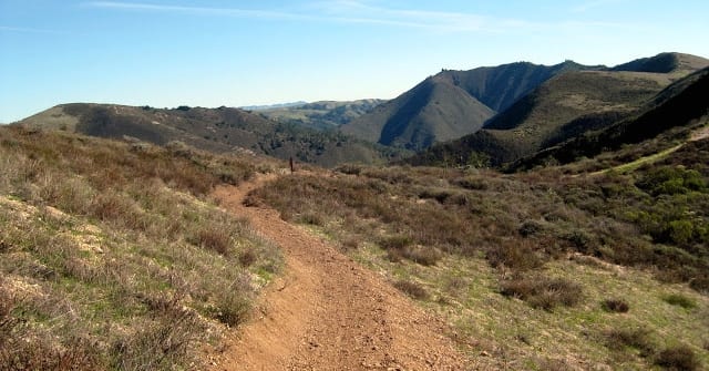
The second highest point located in the Montaña de Oro State Park is Oats Peak, which is popular among many hikers and horseback riders. Oats Peak is 26 feet higher than Valencia Peak, which is the favorite summit for many hikers in the area. It is located a few miles inland from Valencia Peak and has smaller views of the ocean and larger views of the Irish Hills, which are the ridges and the canyons that make up the interior area of the state park.
Features:
There is a pair of trails that intertwine that hikers can use to reach the summit of the peak, which reaches 1373 feet. The trails travel east from the coast and along Islay Creek Canyon, which is below Valencia Peak. The trail climbs to a beautiful and remote area of Montaña de Oro State Park.
There is a new trail that leads to the peaks, which is shorter than the older trail. Some hikers like to go up using the newer trail and come down on the old one to lengthen the hike. You will not have to make a decision on which trail to take until later in the hike, as there is only one starting point to go up the peak.
You will experience several panoramic views throughout your hike to both peaks.
Table of Contents
Top 3 Adventure Hacks
1) Get to the Summit Fast
Take the Valenciana Peak Trail because this is the shortest and most direct way to the summit.
2) Set Camp
When taking these trails, the campground is near Spooners Cove. You could call and make reservations if you want to go camping. If you do decide to go on a camping trip, make it a comfortable one by bringing an ultralight mummy sleeping bag to keep you warm at night!
3) Don’t starve yourself
Bring enough food for your hike and lots of drinking water!


