
The United States of America has over 10,000 state parks covering more than 18 million acres across its entire territory. With each park featuring its own blend of terrain, weather, and climate, it’s no surprise that they’ve become so popular with those looking for outdoor adventure, especially hiking.
Take a Hike Through These Awesome State Parks
If you’re looking to do some state park hiking yourself, then this article is for you. Here you’ll find our attempt at listing down the USA’s best state parks for hiking and boiling it all down to just 12.
So, let’s get started:
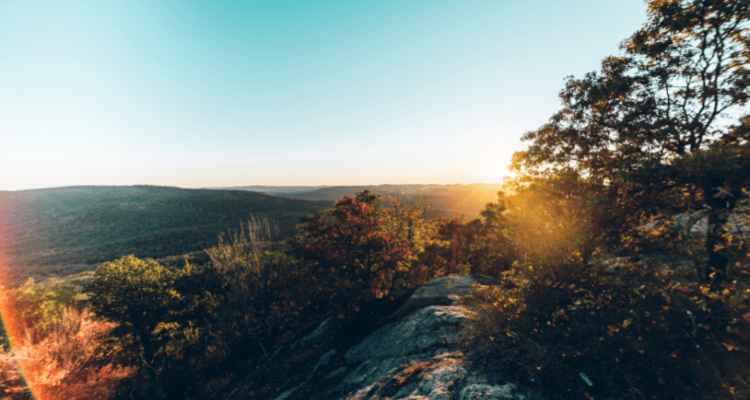
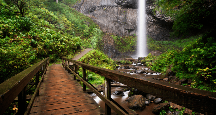
1. Silver Falls State Park: Oregon’s Most Popular State Park
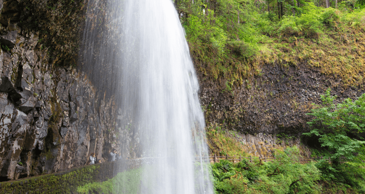
Silver Falls State Park is located in the State of Oregon, near Silverton, about 20 miles east-southeast of Salem. The park covers over 9,000 acres of land and is the largest state park in Oregon. Silver Falls State Park contains 24 miles of hiking trails within its area.
Whether you’re a beginner, experienced, or expert hiker, odds are you’ll find a trail you’ll like in Silver Falls State Park. Some of the park’s most recommended trails include South Falls via Canyon Trail (easy), Trail of Ten Falls (moderate), and Trail of Ten Falls & Buck Mountain Loop (hard).
2. Lost Dutchman State Park: Wildflowers and Desert Wildlife
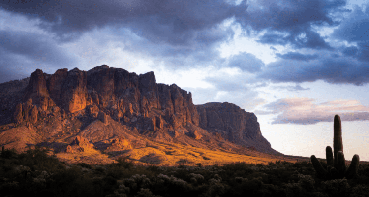
Lost Dutchman State Park is located in northwestern Pinal County, Arizona on the Apache Trail, north of Apache Junction, near the Superstition Mountains in central Arizona.
The park got its name from the famous lost gold mine often mentioned in Old Western legends. It acts as the trailhead for the numerous trails leading into Tonto National Forest and the Superstition Mountain Wilderness.
Lost Dutchman State Park’s most popular trail – Flatiron via Siphon Draw Trail – is also its toughest. The rest of the park’s trails are easy and it currently doesn’t have any moderate-rated ones.
3. Olallie State Park: Home of the 135-foot-high Twin Falls
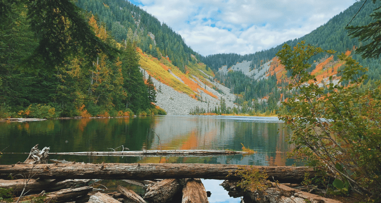
Olallie State Park is a public recreation area located five miles southeast of North Bend, Washington. The park stretches 3.5 miles along the South Fork of the Snoqualmie River. It features multiple waterfalls, including the most prominent 135-foot-high Twin Falls.
Apart from the waterfalls, the park also features fascinating rock formations, lush forests, and a rushing river along with great views of the Snoqualmie Valley. Popular hiking trails in the park include the Twin Falls Trail (moderate), Mount Washington Trail (hard), and the Olallie Trail (hard).
4. Wallace Falls State Park: Hiking Haven for Experienced Hikers
Wallace Falls State Park is a public recreation area located on the west side of the Cascade Mountains with an entrance point just one mile northeast of the community of Gold Bar. The park covers a total of 1,380 acres along the Wallace River in Snohomish County, Washington. It features varied terrain including backcountry lakes, rushing mountain rivers, streams, waterfalls, and old-growth coniferous forests, as well as the ruins of railroad trestles and disused railroad grades.
The park has 12 miles of hiking trails that take you close to the beautiful waterfalls or along the Wallace River shore. All the park’s trails are rated moderate and include Wallace Falls via Woody Trail, Wallace Falls, Wallace Lake Loop, and the Railroad Grade Trail.
5. Bear Mountain State Park: Hiking Fun Amidst the Rugged Mountains
Bear Mountain State Park is located on the west bank of the Hudson River in Rockland and Orange counties, New York. It spans over 5,200 acres and includes several facilities including the Perkins Memorial Tower, the Bear Mountain Inn, the Trailside Museum and Zoo, a pool, a merry-go-round, and a skating rink.
The park has over 50 official hiking trails spanning 235 miles. There’s something for every hiker, although most trails require a bit of experience due to the elevation levels. Some recommended trails include the Hessian Lake Loop (easy), Bear Mountain Loop Trail (moderate), and Timp Torne Loop Trail (hard).
6. Mount Tamalpais State Park: Panoramic Views on Fogless Days
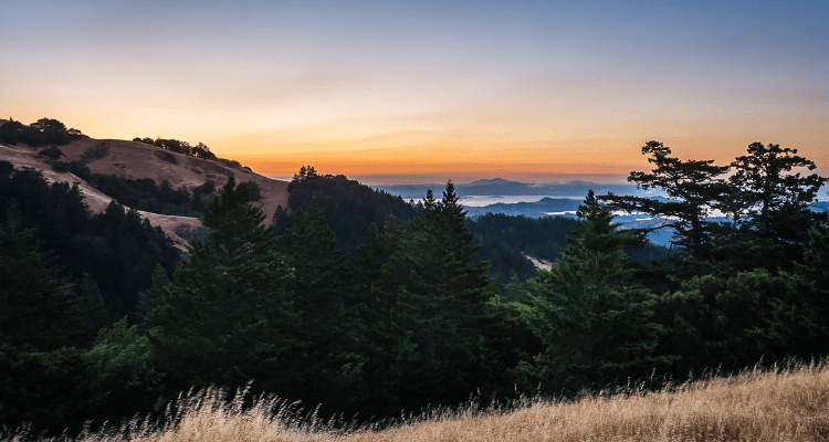
Mount Tamalpais State Park is a California state park located in Marin County, California. The park encompasses 6,300 acres and features oak and redwood forests, golden grasslands, scenic views of the Golden Gate Bridge, and the 2,571-foot-high Mount Tamalpais.
The park offers 70+ hiking trails spanning a total of 60 miles. While the park is foggy most days, clear days give hikers a glimpse of the Farallon Islands, the San Francisco bay, the cities of the East Bay, and even Mount Diablo.
Notable trails include Verna Dunshee Trail and Plank Trail at Mount Tam East Peak (easy), Dipsea Trail, Steep Ravine Trail, and Matt Davis Loop (moderate), and Stinson Beach to Mount Tamalpais via Matt Davis Trail (hard).
7. Topanga State Park: Largest Park Within City Limits
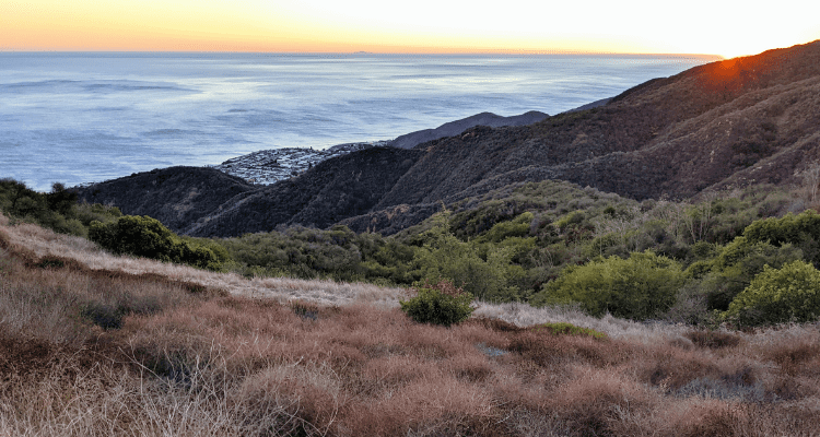
Another great state park in California is Topanga State Park located in the Santa Monica Mountains, within Los Angeles County, California. It covers 11,000 acres and includes 36 miles of trails. The park is not only the largest in the Santa Monica Mountains, but it is also the largest park located within the limits of a city.
Hikers in Topanga State Park get to witness stunning views of live oak, open grassland, and the Pacific ocean. The park itself also offers interesting geologic formations like marine fossils, earthquake faults, volcanic intrusions, and various sedimentary formations.
Popular trails include Temescal Canyon Trail, Los Leones Trail, and Skull Rock Loop – all rated moderate.
8. Minnewaska State Park Preserve: Prime Picnic Spot with Great Overlook
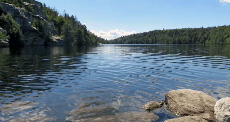
Minnewaska State Park Preserve is a preserve located on the Shawangunk Ridge in Ulster County, New York on US 44/NY 55, five miles west of New York State Route 299. It covers over 22,200 acres and is renowned for its scenic overlooks of the nearby Catskill Mountains.
Notable trails include Lake Minnewaska Carriage Road Loop (easy), Gertrude’s Nose and Millbrook Mountain Loop (moderate), and High Peters Kill Trail (hard).
9. Guy W. Talbot State Park: Home of the Beautiful Latourelle Falls
Guy W. Talbot State Park is a state park located in the Columbia River Gorge, near Troutdale, Oregon, United States. It’s most famous for its beautiful 250-foot Latourelle Falls.
The park only has two trails, which are both quite popular among hikers. The Latourell Falls Trail is family-friendly and a great hike before a picnic by the falls. You can also hike this same trail as a loop which makes it a bit more challenging.
10. Hudson Highlands State Preserve: Location of One of America’s Best Day Hikes
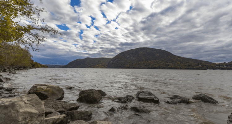
Hudson Highlands State Park Preserve in New York is a series of parcels of land spanning 6,000 acres from Annsville Creek in Peekskill, north to Dennings Point in Beacon. The spacious park gives awesome panoramic views of the river and mountains.
Notable trails include Cornish Estate Trail (easy), Bull Hill Full Loop (moderate), and the ever-popular Breakneck Ridge, Breakneck Bypass, and Wilkinson Trail Loop (hard) – One of America’s top 10 day hikes.
11. Crystal Cove State Park: Great Hike with Views of the Beach
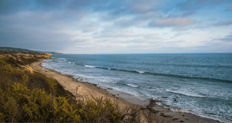
Crystal Cove State Park is a California state park located in Newport Beach and is part of the larger South Coast Wilderness area. It encompasses about 3,900 acres and covers 3.2 miles of the Pacific coastline. Most visitors come to the park to hike, surf, and enjoy the beach with family.
Popular trails include Reef Point and Crystal Cove Trail (easy), El Moro Canyon Loop Trail (moderate), and Pacific Ridge, Moro Canyon, and Boomer Ridge Trail Loop (hard).
12. Mount Pilchuck State Park: Spectacular Summit Views
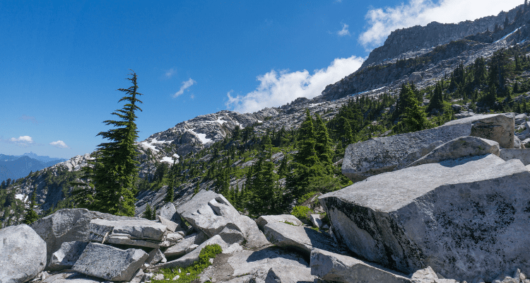
Mount Pilchuck State Park is a public recreation area located seven miles east of Granite Falls, Washington, on the western edges of the Cascade Mountains. It encompasses about 1,900 acres and features alpine scenery, Mount Pilchuck itself, and a fire lookout at the summit.
The park only has 3 trails, 2 of which are rated “hard”. These are Pinnacle Lake Trail (moderate), Mount Pilchuck Trail (hard), and Herman’s Peak (hard).
MORE ADVENTURE RELATED READING:
8 Of the Best Places for Outdoor Family Adventure
10 Reasons Why AdventureHacks The Online Camping Store Is For You
7 Epic Hiking Trails In 7 Amazing USA National Parks
Day Hiking Checklist – Everything You’ll Need For Most Hikes
15 Best Trail Towns In The United States
LIKE THIS ARTICLE ON THE BEST STATE PARKS FOR HIKING?
Please consider sharing Truth Social & Twitter.
To your next adventure!
-David & Team AdventureHacks

About the Author
I'm David, Founding Nomad of AdventureHacks, Inc. My mission is to inspire adventure on the ground, in the water and through the air. If I also happen to inspire you to purchase gear, my team and I plant a tree in its native environment for every order.


